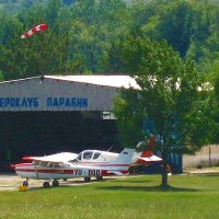
Paracín / Davidovac Airport
Paracín / Davidovac Airport is a small airport in Central Serbia, Serbia. The airport is located at latitude 43.86639 and longitude 21.48694. The airport has one runway: 10/28. The ICAO airport code of this field is LYPN. Nearby other airfields are Cuprija, Jagodina / Barutana Airfield, Krusevac-kosirsko Polje, Trstenik Airport and Bor Airport.
Paracín / Davidovac Airport does not publish a METAR, the nearest weather station is Nis Airport, which is 66 km away. The flight information region (FIR) is Beograd.
Paracín / Davidovac Airport is in the timezone of Europe/Belgrade. Difference with UTC is +2 h. Today the sun rises at 05:19 and sets at 19:41. This applies to Paracín / Davidovac Airport, the universal daylight period may be different. The difference between the local time and UTC is +2 hour. Daylight saving time is currently in progress.Things to do at this airport
Go to Vliegles.nl to find flying lessons, skydives and other flying experiences. Browse the page for all available activities near Paracín / Davidovac Airport. You can also use the search function to find specific flying lessons, skydives or other flying experiences near your place.
On this airport you can find skydive centers. The only known company on this field is Paracin.