Innisfail Airport

YIFL · Queensland, Australia

About Innisfail Airport

ICAO YIFL
IATA IFL
FIR Brisbane FIR
Region Queensland
Country Australia
Runways 3/21
Type Small airport
Coordinates (ARP) -17.5594, 146.01199   173334S 1460043E
Coordinates (Center) -17.55918, 146.01175   173333S 1460042E
Variation 6.8° E (2024)
Timezone Brisbane (+10 h)
Local time May 1, 2024 08:49

Runways

ID True Heading Magnetic Heading Length Width Surface Latitude Longitude
14 141° 134° 1,353 m 30 m Asphalt -17.5638 146.0151
32 321° 314° -17.5542 146.007
3 035° 028° 1,344 m 30 m Sand -17.5540 146.0162
21 215° 208° -17.5648 146.0084

Do not use for flight planning
The airport may be closed or require prior permission. True headings and the coordinates of runway ends may be an estimation. Magnetic headings are calculated from true headings using the WMM 2020 model.

Innisfail Airport

Innisfail Airport is a small airport in Queensland, Australia. The airport is located at latitude -17.55918 and longitude 146.01175. The airport has 2 runways: 14/32 and 3/21. The ICAO airport code of this field is YIFL. The airport's IATA code is IFL. Nearby other airfields are Tully Airport, Dunk Island Airport, Atherton Airport, Herberton Airport and Dallachy(Cardwell) Aerodrome.

Innisfail Airport does not publish a METAR, the nearest weather station is Cairns International Airport, which is 81 km away. The flight information region (FIR) is Brisbane.

Innisfail Airport is in the timezone of Australia/Brisbane. Difference with UTC is +10 h. Today the sun rises at 06:28 and sets at 17:57. This applies to Innisfail Airport, the universal daylight period may be different. The difference between the local time and UTC is +10 hour. Daylight saving time is currently in progress.

Things to do at this airport

Go to Vliegles.nl to find flying lessons, skydives and other flying experiences. Browse the page for all available activities near Innisfail Airport. You can also use the search function to find specific flying lessons, skydives or other flying experiences near your place.

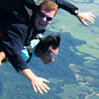
On this airport you can find skydive centers. The only known company on this field is Tandem Cairns.
Companies

Skydive centers

Add company

References

Nearby airports

Airport ID Distance Direction
Innisfail Hospital Heliport YXIS 4.9 km 023°
Tully Hospital Heliport. AU-0190 42 km 192°
Tully Airport YTUY 42 km 190°
Dunk Island Airport YDKI 44 km 162°
Atherton Airport YATN 63 km 302°
Atherton District Memorial Hospital Heliport YXAT 65 km 300°
Herberton Airport YHTN 67 km 282°
Cardwell/Dallachy YCDW 69 km 185°
Cairns Base Hospital Heliport. YCBH 76 km 340°

Navigational aids

Name Ident Type Distance Direction
Innisfail IFL NDB 0.4 km 129°
Report a change