Dubnica

LZDB · Trenčiansky kraj, Slovakia

About Dubnica

ICAO LZDB
FIR Bratislava FIR
Region Trenčiansky kraj
Country Slovakia
Runways 5L/23R
Type Small airport
Coordinates (ARP) 48.9969, 18.1922   485949N 0181132E
Coordinates (Center) 48.99701, 18.19232   485949N 0181132E
Variation 5.7° E (2024)
Timezone Bratislava (+2 h)
Local time Apr 28, 2024 16:34

Runways

ID True Heading Magnetic Heading Length Width Surface Latitude Longitude
5R 050° 044° 1,100 m Unknown 49.0000 18.1983
23L 230° 224° 48.9937 18.1868
5L 050° 044° 1,100 m Unknown 49.0004 18.1978
23R 230° 224° 48.994 18.1864

Do not use for flight planning
The airport may be closed or require prior permission. True headings and the coordinates of runway ends may be an estimation. Magnetic headings are calculated from true headings using the WMM 2020 model.

Dubnica

Dubnica is a small airport in Trenčiansky kraj, Slovakia. The airport is located at latitude 48.99701 and longitude 18.19232. The airport has 2 runways: 5R/23L and 5L/23R. The ICAO airport code of this field is LZDB. Nearby other airfields are Trenčín Airfield, Domaniža Airfield, Bojkovice Airfield, Prusy Airstrip and Dlžín Airstrip.

Dubnica does not publish a METAR, the nearest weather station is Žilina Airport, which is 40 km away. The flight information region (FIR) is Bratislava.

Dubnica is in the timezone of Europe/Bratislava. Difference with UTC is +2 h. Today the sun rises at 05:30 and sets at 19:58. This applies to Dubnica, the universal daylight period may be different. The difference between the local time and UTC is +2 hour. Daylight saving time is currently in progress.

Things to do at this airport

Go to Vliegles.nl to find flying lessons, skydives and other flying experiences. Browse the page for all available activities near Dubnica. You can also use the search function to find specific flying lessons, skydives or other flying experiences near your place.

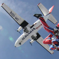
On this airport you can find skydive centers. Companies on this airport are Slovak Air Boogie and SKYDIVE Slavnica.
Companies

Skydive centers

Add company

Nearby airports

Airport ID Distance Direction
Trenčín Airfield LZTN 20 km 224°
Klobouky CZ-0220 22 km 324°
Domaniža Airfield SK-0046 27 km 076°
Bojkovice Airfield CZ-0132 28 km 277°
Prusy Airstrip SK-0023 28 km 169°
Dlžín Airstrip SK-0054 31 km 132°
Tužina Airstrip SK-0044 34 km 109°
Bánov Airstrip CZ-0147 36 km 267°
Luhacovice LKLU 36 km 287°

Navigational aids

Name Ident Type Distance Direction
Trencin TR NDB 24 km 230°
Zilina ZLA NDB 33 km 045°
Report a change