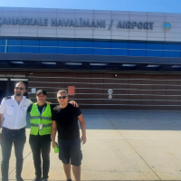
Çanakkale Airport

LTBH · Canakkale, Türkiye

About Çanakkale Airport

ICAO LTBH
IATA CKZ
FIR Istanbul FIR
Region Canakkale
Country Türkiye
Runways 4/22
Type Midsized airport
Coordinates (ARP) 40.1377, 26.4268   400816N 0262536E
Coordinates (Center) 40.13535, 26.4244   400807N 0262528E
Variation 5.7° E (2024)
Timezone Istanbul (+3 h)
Local time May 5, 2024 23:41

Runways

ID True Heading Magnetic Heading Length Width Surface Latitude Longitude
4 041° 035° 2,350 m 45 m Concrete 40.1433 26.4335
22 221° 215° 40.1274 26.4153

Do not use for flight planning
The airport may be closed or require prior permission. True headings and the coordinates of runway ends may be an estimation. Magnetic headings are calculated from true headings using the WMM 2020 model.

Çanakkale Airport

Çanakkale Airport is a midsized airport in Canakkale, Türkiye. The airport is located at latitude 40.13535 and longitude 26.42440. The airport has one runway: 4/22. The ICAO airport code of this field is LTBH. The airport's IATA code is CKZ. Nearby other airfields are Gökçeada Airport, Bozcaada Airport, Keşan Air Base, Kesan and Karabiga Airport.

Çanakkale Airport publishes a METAR. The flight information region (FIR) is Istanbul.

Çanakkale Airport is in the timezone of Europe/Istanbul. Difference with UTC is +3 h. Today the sun rises at 06:08 and sets at 20:13. This applies to Çanakkale Airport, the universal daylight period may be different. The difference between the local time and UTC is +3 hour. Daylight saving time is currently in progress.

Things to do at this airport

Go to Vliegles.nl to find flying lessons, skydives and other flying experiences. Browse the page for all available activities near Çanakkale Airport. You can also use the search function to find specific flying lessons, skydives or other flying experiences near your place.

On this airport you can find flying schools. The only known company on this field is Uludağ Uçuş Okulları ve Genel Havacılık A.Ş.

Companies

Flying schools

Add company

References

Nearby airports

Airport ID Distance Direction
Canakkale LTHC 1.3 km 074°
Anafartalar Çanakkale Public Hospital Helipad TR-0191 2.7 km 350°
Çanakkale Forest Fire Management Center Heliport TR-0180 7.3 km 214°
Kıyı Emniyet Gemi Hizmetleri Merkezi Heliport TR-0162 10 km 360°
Çanakkale Şehitleri Abidesi Helipad TR-0222 20 km 241°
Gökçeada Airport TR-0221 46 km 280°
Gokceada LTFK 47 km 279°
Bozcaada Airport TR-0008 49 km 228°
Kesan LTFL 74 km 011°

Navigational aids

Name Ident Type Distance Direction
Canakkale CNK VOR-DME 0.9 km 048°
Report a change