Clinceni Airfield

LRCN · Ilfov, Romania

About Clinceni Airfield

ICAO LRCN
FIR Bucuresti FIR
Region Ilfov
Country Romania
Runways 6R/24L
Type Small airport
Coordinates (ARP) 44.35902, 25.93196   442132N 0255555E
Coordinates (Center) 44.35852, 25.93073   442131N 0255551E
Variation 6.3° E (2024)
Timezone Bucharest (+3 h)
Local time May 2, 2024 06:36

Clinceni Airfield

Clinceni Airfield is a small airport in Ilfov, Romania. The airport is located at latitude 44.35852 and longitude 25.93073. The airport has 2 runways: 6L/24R and 6R/24L. The ICAO airport code of this field is LRCN. Nearby other airfields are Aerodrom Letca Nouă, Băneasa International Airport, Gradistea, Comana Airstrip and Aerodrom Ciocănești.

Clinceni Airfield does not publish a METAR, the nearest weather station is Băneasa International Airport, which is 21 km away. The flight information region (FIR) is Bucuresti.

Clinceni Airfield is in the timezone of Europe/Bucharest. Difference with UTC is +3 h. Today the sun rises at 06:04 and sets at 20:21. This applies to Clinceni Airfield, the universal daylight period may be different. The difference between the local time and UTC is +3 hour. Daylight saving time is currently in progress.

Things to do at this airport

Go to Vliegles.nl to find flying lessons, skydives and other flying experiences. Browse the page for all available activities near Clinceni Airfield. You can also use the search function to find specific flying lessons, skydives or other flying experiences near your place.

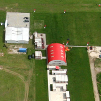
On this airport you can find skydive centers. The only known company on this field is TNT Brothers Dropzone.
Companies

Skydive centers

Add company

References

Do not use for flight planning
The airport may be closed or require prior permission. True headings and the coordinates of runway ends may be an estimation. Magnetic headings are calculated from true headings using the WMM 2020 model.

Runways

ID True Heading Magnetic Heading Latitude Longitude Approx. length
6L 063° 056° 44.3611 25.9367 1,096 m
24R 243° 236° 44.3566 25.9244
6R 063° 056° 44.3603 25.9365 999 m
24L 243° 236° 44.3562 25.9253

Do not use for flight planning.
True headings and the coordinates of runway ends may be an estimation. Runway lengths are calculated as the distance between the coordinates of the runway ends. Magnetic headings are calculated from true headings using the WMM 2020 model.

Nearby airports

Airport ID Distance Direction
Crystal Tower Bucharest Helipad RO-0064 17 km 051°
Aerodrom Letca Nouă RO-0065 21 km 224°
Unitatea Specială de Aviație București RO-0029 21 km 039°
Băneasa International Airport LRBS 21 km 040°
Gradistea LRBA 21 km 134°
Comana Airstrip RO-0019 24 km 136°
Aerodrom Ciocănești RO-0032 26 km 346°
Henri Coandă International Airport LROP 27 km 029°
Vânătorii Mici Airfield RO-0047 31 km 298°

Navigational aids

Name Ident Type Distance Direction
Baneasa Southwest BSW NDB 13 km 007°
Baneasa West B NDB 18 km 039°
Otopeni OPW NDB 23 km 010°
Baneasa East A NDB 24 km 044°
Floresti FLR VOR-DME 24 km 311°
Otopeni OTL NDB 24 km 013°
Baneasa Southeast BSE NDB 30 km 051°
Otopeni OPE NDB 33 km 042°
Report a change