Grenoble-Alpes Isère

LFLS · Isère, Auvergne-Rhône-Alpes, France

About Grenoble-Alpes Isère

ICAO LFLS
IATA GNB
FIR Marseille FIR
Region Auvergne-Rhône-Alpes
Country France
Runways 9R/27L
Type Midsized airport
Coordinates (ARP) 45.3629, 5.32937   452146N 0051946E
Variation 2.7° E (2024)
Timezone Paris (+2 h)
Local time May 6, 2024 12:10

Runways

ID True Heading Magnetic Heading Length Width Surface Latitude Longitude
9 089° 086° 3,050 m 45 m Asphalt 45.3629 5.3488
27 269° 266° 45.363 5.3099
9R 090° 087° 900 m 50 m Grass 45.3629 5.3488
27L 270° 267° 45.363 5.3099

Do not use for flight planning
The airport may be closed or require prior permission. True headings and the coordinates of runway ends may be an estimation. Magnetic headings are calculated from true headings using the WMM 2020 model.

Grenoble-Alpes Isère

Grenoble-Alpes Isère is a midsized airport in Isère, Auvergne-Rhône-Alpes, France. The airport is located at latitude 45.36290 and longitude 5.32937. The airport has 2 runways: 9/27 and 9R/27L. The ICAO airport code of this field is LFLS. The airport's IATA code is GNB. Nearby other airfields are La Tour Du Pin Airfield, St Jean D'avelanne Airfield, Morestel Airport, Saint-Jean-en-Royans Airport and Aérodrome de Romans - Saint-Paul.

Grenoble-Alpes Isère publishes a METAR. The flight information region (FIR) is Marseille.

Grenoble-Alpes Isère is in the timezone of Europe/Paris. Difference with UTC is +2 h. Today the sun rises at 06:18 and sets at 20:51. This applies to Grenoble-Alpes Isère, the universal daylight period may be different. The difference between the local time and UTC is +2 hour. Daylight saving time is currently in progress.

Things to do at this airport

Go to Vliegles.nl to find flying lessons, skydives and other flying experiences. Browse the page for all available activities near Grenoble-Alpes Isère. You can also use the search function to find specific flying lessons, skydives or other flying experiences near your place.

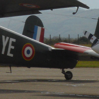
On this airport you can find flying clubs and skydive centers. Companies on this airport are Aéroclub des Personnels du SEFA Grenoble, Aéroclub de Grenoble Isère et sa Région - AGIR and Parachutisme 38.

Companies

Flying clubs

Skydive centers

Add company

References

Nearby airports

Airport ID Distance Direction
La Tour Du Pin Airfield LFKP 22 km 011°
Bourgoin Jallieu Centre Hospitalier Oudo FR-0609 27 km 345°
Hôtel Le Château Heliport FR-0232 30 km 032°
St Jean D'avelanne Airfield LFKH 32 km 057°
Frontonas FR-0744 33 km 339°
Ratières Les Allandaines FR-1014 35 km 231°
Hôpital Nord Heliport FR-0228 37 km 118°
Morestel Airport LFHI 37 km 014°
Saint-Jean-en-Royans Airport LFKE 37 km 182°

Navigational aids

Name Ident Type Distance Direction
La Tour Du Pin LTP VOR-DME 16 km 031°
Tour Du Pin LNP VOR 17 km 031°
Report a change