Lompoc Airport

KLPC · California, United States

About Lompoc Airport

LOMPOC
ICAO KLPC
FAA ID LPC
IATA LPC
Type Midsized airport
Open since March 1962
Coordinates (ARP) 34.66562, -120.4675   343956N 1202803W
Variation 12.0° E (2024)
Timezone Los_Angeles (-7 h)
Local time May 3, 2024 16:34
Fuel types
100LL 100LL gasoline, low lead (Blue)
A Jet A, Kerosene (-40°C)
Usage Public (Joint use)
Operations (annual) 30,000 (October 16, 2023)
Based aircraft 42
Airport status Operational
Source FAA (Effective date April 18, 2024)

Runways

ID True Heading Magnetic Heading Length Width Surface Latitude Longitude
7 091° 078° 4,600 ft 98 ft Asphalt 34.6657 -120.4752
25 271° 258° 34.6655 -120.4599

Do not use for flight planning
The airport may be closed or require prior permission. Magnetic headings are calculated from true headings using the WMM 2020 model.

More information

Lompoc Airport

Lompoc Airport is a midsized airport in California, United States. The airport is located at latitude 34.66562 and longitude -120.46750. The airport has one runway: 7/25. The ICAO airport code of this field is KLPC. The local airport ID (FAA LID) of this airport is LPC. The airport's IATA code is LPC. Nearby other airfields are Vandenberg Space Force Base, Santa Maria Pub/Capt G Allan Hancock Field, Santa Ynez/Kunkle Field, Shepherd Farm Airport and Oceano County Airport.

Lompoc Airport publishes a METAR. The flight information region (FIR) is Los Angeles.

Lompoc Airport is in the timezone of America/Los_Angeles. Difference with UTC is -7 h. Today the sun rises at 06:08 and sets at 19:48. This applies to Lompoc Airport, the universal daylight period may be different. The difference between the local time and UTC is -7 hour. Daylight saving time is currently in progress.

Things to do at this airport

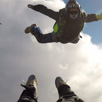
Go to Vliegles.nl to find flying lessons, skydives and other flying experiences. Browse the page for all available activities near Lompoc Airport. You can also use the search function to find specific flying lessons, skydives or other flying experiences near your place.

On this airport you can find skydive centers. The only known company on this field is Skydive Santa Barbara.

Companies

Skydive centers

Add company

References

Nearby airports

Airport ID Distance Direction
Vandenberg Space Force Base KVBG 7.2 NM 306°
Santa Maria Pub/Capt G Allan Hancock Field KSMX 14 NM 001°
Platform Hermosa Heliport US-0918 15 NM 215°
Platform Hidalgo Heliport US-0920 16 NM 228°
Platform Harvest Heliport US-0919 16 NM 221°
Marian Medical Center Heliport US-1149 17 NM 009°
Santa Ynez/Kunkle Field KIZA 20 NM 100°
Shepherd Farm Airport US-1152 20 NM 097°
Platform Ocs P-0188 Hondo Heliport US-1140 24 NM 133°

Navigational aids

Name Ident Type Distance Direction
Vandenberg VBG TACAN 7.0 NM 305°

More runway information

Condition

ID Surface condition Surface treatment PCN
Pavement Classification Number
Runway Lights Edge Intensity
7 Excellent No special treatment Medium
25

Weight Bearing Capacity

ID Single wheel Double wheel Double tandem Dual double tandem
7 17,000 lbs
25

Declared distances

ID TORA
Takeoff Run Available
TODA
Takeoff Distance Available
ASDA
Accelerated Stop Distance Available
LDA
Landing Distance Available
Displaced Threshold
Length
7
25 118 ft

Elevations

ID End Elevation Threshold Crossing Height Visual Glide Path Angle Touchdown Zone Elevation Displaced Threshold
Elevation
7 79 ft 24 ft
25 88 ft 25 ft 3.3° 27 ft 88 ft

Obstruction data

ID Controlling Object
Description
Controlling Object
Marking
CFR Part 77 Controlling Object
Clearance slope
Controlling Object
Height (AGL)
Controlling Object
Distance Threshold
Controlling Object
Centerline offset
Controlling Object
Centerline
7 BRUSH A(V) 20 25 ft 719 ft 0 ft
25 PLINE Marked A(NP) 34 25 ft 1,050 ft 0 ft

Lights and markings

ID Runway Markings
Type
Runway Markings
Condition
Approach Light System Runway End Identifier Lights Centerline Lights Touchdown Lights Visual Glide Slope Indicators
7 Nonprecision Instrument Good No No No
25 Nonprecision Instrument Good Yes No No P4L

Other information

ID ILS type Pattern Runway Visual Range
Equipment
Runway Visibility Value
Equipment
7 Left hand
813 ft
No
25 Right hand
813 ft
No
Report a change