Aviosuperficie Rinaura
Aviosuperficie Rinaura is a small airport in Sicily, Italy. The airport is located at latitude 37.02865 and longitude 15.24351. The airport has one runway: 3/21. This airport has no ICAO code, we use IT-0012 as reference. Nearby other airfields are Aviosuperficie Avola-Gallina, Aviosuperficie Aretusa Fly, Sigonella Navy Air Base, Sigonella, NAS and Catania-Fontanarossa Airport.
Aviosuperficie Rinaura does not publish a METAR, the nearest weather station is Sigonella Navy Air Base, which is 50 km away. The flight information region (FIR) is Roma.
Aviosuperficie Rinaura is in the timezone of Europe/Rome. Difference with UTC is +2 h. Today the sun rises at 05:57 and sets at 19:53. This applies to Aviosuperficie Rinaura, the universal daylight period may be different. The difference between the local time and UTC is +2 hour. Daylight saving time is currently in progress.Things to do at this airport
Go to Vliegles.nl to find flying lessons, skydives and other flying experiences. Browse the page for all available activities near Aviosuperficie Rinaura. You can also use the search function to find specific flying lessons, skydives or other flying experiences near your place.
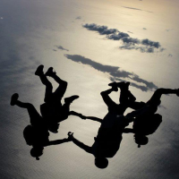
On this airport you can find skydive centers. The only known company on this field is Skydive Sicilia Dropzone.