El Berriel Aeroc Airport

GCLB · Las Palmas, Canary Islands, Spain

About El Berriel Aeroc Airport

ICAO GCLB
FIR Canarias FIR
Region Canary Islands
Country Spain
Runways 7/25
Type Small airport
Coordinates (ARP) 27.7825, -15.5072   274657N 0153026W
Coordinates (Center) 27.7824, -15.50739   274657N 0153027W
Variation 3.6° W (2024)
Timezone Canary (+1 h)
Local time May 6, 2024 23:56

El Berriel Aeroc Airport

El Berriel Aeroc Airport is a small airport in Las Palmas, Canary Islands, Spain. The airport is located at latitude 27.78240 and longitude -15.50739. The airport has one runway: 7/25. The ICAO airport code of this field is GCLB. Nearby other airfields are Gran Canaria Airport, Tenerife Sur Airport, Tenerife Norte-Ciudad de La Laguna Airport, Antigua Fuerteventura and La Gomera Airport.

El Berriel Aeroc Airport does not publish a METAR, the nearest weather station is Gran Canaria Airport, which is 20 km away. The flight information region (FIR) is Canarias.

El Berriel Aeroc Airport is in the timezone of Atlantic/Canary. Difference with UTC is +1 h. Today the sun rises at 07:18 and sets at 20:39. This applies to El Berriel Aeroc Airport, the universal daylight period may be different. The difference between the local time and UTC is +1 hour. Daylight saving time is currently in progress.

Things to do at this airport

Flying lessons are available at this airport. You can book a flying lesson without any prior experience. The most booked type of flying lesson at El Berriel Aeroc Airport is Basic flying lesson. The price of these lessons start at € 239. Read more about Basic flying lesson here. You can also make your booking on this website.

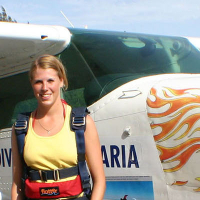
On this airport you can find flying schools and skydive centers. Companies on this airport are Vliegles.nl and Skydive Gran Canaria.

Companies

Flying schools

Skydive centers

Add company

References

Do not use for flight planning
The airport may be closed or require prior permission. True headings and the coordinates of runway ends may be an estimation. Magnetic headings are calculated from true headings using the WMM 2020 model.

Runways

ID True Heading Magnetic Heading Latitude Longitude Approx. length
7 068° 071° 27.7837 -15.5036 804 m
25 248° 251° 27.7811 -15.5112

Do not use for flight planning.
True headings and the coordinates of runway ends may be an estimation. Runway lengths are calculated as the distance between the coordinates of the runway ends. Magnetic headings are calculated from true headings using the WMM 2020 model.

Nearby airports

Airport ID Distance Direction
Gran Canaria Airport GCLP 20 km 035°
Tejeda Heliport ES-0308 26 km 336°
Hospital Universitario De Canarias Heliport GCHU 107 km 314°
Tenerife Sur Airport GCTS 109 km 285°
Tenerife Norte-Ciudad de La Laguna Airport GCXO 113 km 313°
Tenerife Norte/Los Rodeos GCXM 114 km 313°
Morro Jable Heliport ES-0325 117 km 074°
Antigua Fuerteventura GCAT 164 km 065°

Navigational aids

Name Ident Type Distance Direction
Gran Canaria LPC VOR-DME 9.0 km 055°
Gran Canaria VR NDB 12 km 046°
Gran Canaria TGN TACAN 19 km 036°
Report a change