Hibaldstow Airfield

GB-0072 · England, United Kingdom

About Hibaldstow Airfield

ID GB-0072
FIR London FIR
Region England
Country United Kingdom
Runways 14/32
Type Small airport
Coordinates (ARP) 53.4956, -0.51773   532944N 0003104W
Coordinates (Center) 53.49716, -0.51707   532950N 0003101W
Variation 0.6° E (2024)
Timezone London (+1 h)
Local time Apr 27, 2024 09:09

Hibaldstow Airfield

Hibaldstow Airfield is a small airport in England, United Kingdom. The airport is located at latitude 53.49716 and longitude -0.51707. The airport has 2 runways: 7/25 and 14/32. This airport has no ICAO code, we use GB-0072 as reference. Nearby other airfields are Kirton-in-Lindsey Glider Field, North Moor, Brookfield Farm Airstrip, Humberside Airport and Sturgate Airfield.

Hibaldstow Airfield does not publish a METAR, the nearest weather station is Humberside Airport, which is 14 km away. The flight information region (FIR) is London.

Hibaldstow Airfield is in the timezone of Europe/London. Difference with UTC is +1 h. Today the sun rises at 05:34 and sets at 20:25. This applies to Hibaldstow Airfield, the universal daylight period may be different. The difference between the local time and UTC is +1 hour. Daylight saving time is currently in progress.

Things to do at this airport

Go to Vliegles.nl to find flying lessons, skydives and other flying experiences. Browse the page for all available activities near Hibaldstow Airfield. You can also use the search function to find specific flying lessons, skydives or other flying experiences near your place.

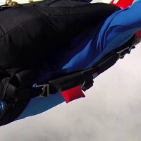
On this airport you can find skydive centers. The only known company on this field is Skydive Hibaldstow.

Companies

Skydive centers

Add company

References

Do not use for flight planning
The airport may be closed or require prior permission. True headings and the coordinates of runway ends may be an estimation. Magnetic headings are calculated from true headings using the WMM 2020 model.

Runways

ID True Heading Magnetic Heading Latitude Longitude Approx. length
7 074° 073° 53.4969 -0.5102 507 m
25 254° 253° 53.4957 -0.5176
14 145° 144° 53.4957 -0.5176 625 m
32 325° 324° 53.5003 -0.523

Do not use for flight planning.
True headings and the coordinates of runway ends may be an estimation. Runway lengths are calculated as the distance between the coordinates of the runway ends. Magnetic headings are calculated from true headings using the WMM 2020 model.

Nearby airports

Airport ID Distance Direction
Kirton-in-Lindsey Glider Field GB-0497 5.6 km 225°
North Moor GB-0227 12 km 290°
Brookfield Farm Airstrip GB-0476 14 km 124°
Humberside Airport EGNJ 14 km 051°
Sturgate Airfield EGCS 17 km 221°
Haxey Airstrip GB-0284 20 km 268°
RAF Scampton EGXP 21 km 186°
Lindens Farm Airstrip GB-0500 22 km 070°
Stow Airstrip GB-0277 22 km 208°

Navigational aids

No navigational aids found in the vicinity of Hibaldstow Airfield.
Report a change