Odense Airport

EKOD · South Denmark, Denmark

About Odense Airport

ICAO EKOD
IATA ODE
FIR Kobenhavn FIR
Region South Denmark
Country Denmark
Runways 6/24
Type Midsized airport
Coordinates (ARP) 55.4767, 10.3309   552836N 0101951E
Coordinates (Center) 55.47565, 10.3279   552832N 0101940E
Variation 4.4° E (2024)
Timezone Copenhagen (+1 h)
Local time Nov 13, 2024 04:13

Runways

ID True Heading Magnetic Heading Length Width Surface Latitude Longitude
6 058° 053° 1,845 m 45 m Asphalt 55.4798 10.3405
24 238° 233° 55.4715 10.3153

Do not use for flight planning
The airport may be closed or require prior permission. True headings and the coordinates of runway ends may be an estimation. Magnetic headings are calculated from true headings using the WMM 2020 model.

Odense Airport

Odense Airport is a midsized airport in South Denmark, Denmark. The airport is located at latitude 55.47565 and longitude 10.32790. The airport has one runway: 6/24. The ICAO airport code of this field is EKOD. The airport's IATA code is ODE. Nearby other airfields are Kerteminde, Bogense Flyveplads, Fangel, Revninge Flyveplads and Rolfsted Airfield.

Odense Airport does not publish a METAR, the nearest weather station is Sønderborg Airport, which is 66 km away. The flight information region (FIR) is Kobenhavn.

Odense Airport is in the timezone of Europe/Copenhagen. Difference with UTC is +1 h. Today the sun rises at 07:49 and sets at 16:16. This applies to Odense Airport, the universal daylight period may be different. The difference between the local time and UTC is +1 hour. Currently, there is no daylight saving time in effect.

Things to do at this airport

Go to Vliegles.nl to find flying lessons, skydives and other flying experiences. Browse the page for all available activities near Odense Airport. You can also use the search function to find specific flying lessons, skydives or other flying experiences near your place.

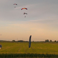
On this airport you can find skydive centers. The only known company on this field is Odense Faldskærmscenter.
Companies

Skydive centers

Add company

References

Nearby airports

Airport ID Distance Direction
Kerteminde DK-0064 17 km 099°
Bogense Flyveplads DK-0005 20 km 292°
Fangel DK-0056 20 km 183°
Schelenburg God Heliport EKSG 21 km 068°
Revninge Flyveplads DK-0036 23 km 106°
Rolfsted EKRO 23 km 136°
Vøjstrup Glider Field EKFS 27 km 197°
Endelave Airfield EKEL 32 km 351°
Sulkendrup Airport DK-0029 32 km 131°

Navigational aids

Name Ident Type Distance Direction
Odin ODN VOR-DME 24 km 060°
Report a change