Breda International Airport

EHSE · North Brabant, Netherlands

About Breda International Airport

ICAO EHSE
FIR Amsterdam FIR
Region North Brabant
Country Netherlands
Runways 6/24
Type Midsized airport
Coordinates (ARP) 51.5547, 4.5525   513317N 0043309E
Coordinates (Center) 51.55502, 4.55336   513318N 0043312E
Variation 2.4° E (2024)
Timezone Amsterdam (+2 h)
Local time Apr 27, 2024 11:58

Runways

ID True Heading Magnetic Heading Length Width Surface Latitude Longitude
6 066° 063° 830 m 23 m Asphalt 51.5566 4.5591
24 246° 243° 51.5534 4.5476

Do not use for flight planning
The airport may be closed or require prior permission. True headings and the coordinates of runway ends may be an estimation. Magnetic headings are calculated from true headings using the WMM 2020 model.

Breda International Airport

Breda International Airport is a midsized airport in North Brabant, Netherlands. The airport is located at latitude 51.55502 and longitude 4.55336. The airport has one runway: 6/24. The ICAO airport code of this field is EHSE. Nearby other airfields are Woensdrecht Air Base, Vliegveld Numansdorp, Brasschaat Airfield, Gilze Rijen Air Base and Hoevenen Airfield.

Breda International Airport does not publish a METAR, the nearest weather station is Woensdrecht Air Base, which is 19 km away. The flight information region (FIR) is Amsterdam.

Breda International Airport is in the timezone of Europe/Amsterdam. Difference with UTC is +2 h. Today the sun rises at 06:19 and sets at 20:58. This applies to Breda International Airport, the universal daylight period may be different. The difference between the local time and UTC is +2 hour. Daylight saving time is currently in progress.

Things to do at this airport

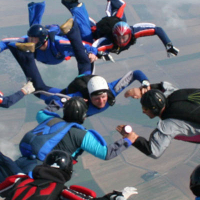
You can make a tandem skydive with an experienced instructor at this airport. These skydives include a free fall. The cost of a skydive at Breda International Airport is € 240. Make your reservation for Skydiving here.

On this airport you can find skydive centers and flying schools. Companies on this airport are Vliegles.nl, Vliegclub Seppe, Aero Ventures, Breda Aviation and Skydive ENPC.

Companies

Skydive centers

Flying schools

Air operators

Flying clubs

Add company

References

Nearby airports

Airport ID Distance Direction
Woensdrecht Air Base EHWO 19 km 231°
Vliegveld Numansdorp EHND 23 km 343°
Brasschaat Airfield EBBT 24 km 188°
Keysers heliport EBBH 24 km 168°
Brecht / Vochten EBBV 25 km 168°
Albert Schweitzer Ziekenhuis. Locatie Amstelwijck Heliport NL-0016 26 km 015°
Gilze Rijen Air Base EHGR 26 km 087°
Luyckx heliport EBBC 28 km 169°
Hoevenen Airfield EBHN 30 km 202°

Navigational aids

Name Ident Type Distance Direction
Woensdrecht WDT TACAN 19 km 230°
Stad STD NDB 30 km 314°
Report a change