Helsinki Malmi

EFHF · Uusimaa, Finland

About Helsinki Malmi

ICAO EFHF
FIR Finland FIR
Region Uusimaa
Country Finland
Runways 9/27
Type Small airport
Coordinates (ARP) 60.255, 25.043   601518N 0250235E
Coordinates (Center) 60.25298, 25.04518   601511N 0250243E
Variation 10.3° E (2024)
Timezone Helsinki (+3 h)
Local time May 5, 2024 23:24

Runways

ID True Heading Magnetic Heading Length Width Surface Latitude Longitude
18 186° 175° 1,340 m 30 m Asphalt 60.2486 25.0415
36 006° 355° 60.2605 25.0441
9 096° 085° 1,024 m 30 m Asphalt 60.2509 25.0567
27 276° 265° 60.2519 25.0384

Do not use for flight planning
The airport may be closed or require prior permission. True headings and the coordinates of runway ends may be an estimation. Magnetic headings are calculated from true headings using the WMM 2020 model.

Helsinki Malmi

Helsinki Malmi is a small airport in Uusimaa, Finland. The airport is located at latitude 60.25298 and longitude 25.04518. The airport has 2 runways: 18/36 and 9/27. The ICAO airport code of this field is EFHF. Nearby other airfields are Helsinki Vantaa Airport, Savikko Airfield, Nummela Airport, Mäntsälä Airport and Hyvinkää Airfield.

Helsinki Malmi does not publish a METAR, the nearest weather station is Helsinki Vantaa Airport, which is 9.1 km away. The flight information region (FIR) is Finland.

Helsinki Malmi is in the timezone of Europe/Helsinki. Difference with UTC is +3 h. Today the sun rises at 05:03 and sets at 21:29. This applies to Helsinki Malmi, the universal daylight period may be different. The difference between the local time and UTC is +3 hour. Daylight saving time is currently in progress.

Things to do at this airport

Go to Vliegles.nl to find flying lessons, skydives and other flying experiences. Browse the page for all available activities near Helsinki Malmi. You can also use the search function to find specific flying lessons, skydives or other flying experiences near your place.

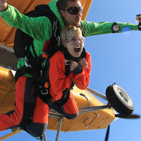
On this airport you can find skydive centers. The only known company on this field is Skyxperience.
Companies

Skydive centers

Add company

References

Nearby airports

Airport ID Distance Direction
Peijaksen Hospital Heliport EFPE 8.7 km 005°
Helsinki Vantaa Airport EFHK 9.1 km 325°
Meilahti Hospital Helipad EFHY 10 km 226°
Hernesaari Heliport EFHE 13 km 209°
Jorvin Hospital Heliport EFEJ 20 km 259°
Savikko Airfield EFNS 32 km 338°
Nummela Airport EFNU 42 km 282°
Mäntsälä Airport EFMN 44 km 035°
Hyvinkää Airfield EFHV 46 km 348°

Navigational aids

Name Ident Type Distance Direction
Uniform U NDB 8.9 km 309°
Hotel H NDB 9.8 km 342°
Helsinki HEL VOR-DME 11 km 331°
Kadis KAD DME 12 km 170°
Korso KOR NDB 13 km 005°
Espoo ESP NDB 14 km 267°
Heka HEK NDB 25 km 089°
Report a change