Kassel-Calden Airport

EDVK · Hesse, Germany

About Kassel-Calden Airport

ICAO EDVK
IATA KSF
FIR Bremen FIR
Region Hesse
Country Germany
Runways 9/27
Type Midsized airport
Coordinates (ARP) 51.41727, 9.38497   512502N 0092306E
Coordinates (Center) 51.4208, 9.39216   512515N 0092332E
Variation 3.8° E (2024)
Timezone Berlin (+2 h)
Local time Apr 28, 2024 15:22

Runways

ID True Heading Magnetic Heading Length Width Surface Latitude Longitude
9 095° 091° 2,500 m 45 m Asphalt 51.4198 9.4101
27 275° 271° 51.4218 9.3742

Do not use for flight planning
The airport may be closed or require prior permission. True headings and the coordinates of runway ends may be an estimation. Magnetic headings are calculated from true headings using the WMM 2020 model.

Kassel-Calden Airport

Kassel-Calden Airport is a midsized airport in Hesse, Germany. The airport is located at latitude 51.42080 and longitude 9.39216. The airport has one runway: 9/27. The ICAO airport code of this field is EDVK. The airport's IATA code is KSF. Nearby other airfields are "Der Dingel" Airfield, Flugplatz „Graner Berg“, Flugplatz Hölleberg, Edermünde-Grifte Airfield and Warburg Airfield.

Kassel-Calden Airport publishes a METAR. The flight information region (FIR) is Bremen.

Kassel-Calden Airport is in the timezone of Europe/Berlin. Difference with UTC is +2 h. Today the sun rises at 05:58 and sets at 20:40. This applies to Kassel-Calden Airport, the universal daylight period may be different. The difference between the local time and UTC is +2 hour. Daylight saving time is currently in progress.

Things to do at this airport

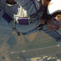
Go to Vliegles.nl to find flying lessons, skydives and other flying experiences. Browse the page for all available activities near Kassel-Calden Airport. You can also use the search function to find specific flying lessons, skydives or other flying experiences near your place.

On this airport you can find flying schools and skydive centers. Companies on this airport are light-wings Flugschule Kassel and Aero Fallschirmsport GmbH Kassel.

Companies

Flying schools

Skydive centers

Add company

References

Nearby airports

Airport ID Distance Direction
Fuldatal Federal Police Heliport EDVZ 10 km 131°
Kassel DE-0764 13 km 160°
"Der Dingel" Airfield DE-0140 13 km 356°
Kassel Klinikum DE-0765 13 km 141°
Hann.-Muenden DE-0712 19 km 097°
Flugplatz „Graner Berg“ EDGW 20 km 230°
Flugplatz Hölleberg EDVL 21 km 001°
Edermünde-Grifte Airfield DE-0146 23 km 170°
Warburg Airfield DE-0211 23 km 292°

Navigational aids

Name Ident Type Distance Direction
Kassel KSL NDB 6.7 km 042°
Warburg WRB VOR-DME 22 km 295°
Lichtenau LAU NDB 32 km 139°
Report a change