Itzehoe/Hungriger Wolf Airfield
Itzehoe/Hungriger Wolf Airfield is a small airport in Schleswig-Holstein, Germany. The airport is located at latitude 53.99058 and longitude 9.57361. The airport has 2 runways: 2/20 and 9/27. The ICAO airport code of this field is EDHF. The airport's IATA code is IZE. Nearby other airfields are Aukrug Airfield, Offenbüttel UL, Rendsburg-Schachtholm Airfield, Neumünster Airport and Flugplatz St. Michaelisdonn.
Itzehoe/Hungriger Wolf Airfield does not publish a METAR, the nearest weather station is Hamburg Helmut Schmidt Airport, which is 48 km away. The flight information region (FIR) is Bremen.
Itzehoe/Hungriger Wolf Airfield is in the timezone of Europe/Berlin. Difference with UTC is +2 h. Today the sun rises at 05:39 and sets at 20:57. This applies to Itzehoe/Hungriger Wolf Airfield, the universal daylight period may be different. The difference between the local time and UTC is +2 hour. Daylight saving time is currently in progress.Things to do at this airport
Go to Vliegles.nl to find flying lessons, skydives and other flying experiences. Browse the page for all available activities near Itzehoe/Hungriger Wolf Airfield. You can also use the search function to find specific flying lessons, skydives or other flying experiences near your place.
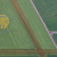
On this airport you can find skydive centers. The only known company on this field is YUU Skydive Fallschirmsport.