Roitzschjora Airfield

EDAW · Saxony, Germany

About Roitzschjora Airfield

ICAO EDAW
FIR Munich FIR
Region Saxony
Country Germany
Runways 10/28
Type Small airport
Coordinates (ARP) 51.57778, 12.49444   513440N 0122940E
Coordinates (Center) 51.57677, 12.49576   513436N 0122945E
Variation 4.7° E (2024)
Timezone Berlin (+2 h)
Local time May 5, 2024 10:32

Runways

ID True Heading Magnetic Heading Length Width Surface Latitude Longitude
10 099° 094° 1,200 m Unknown 51.5760 12.5044
28 279° 274° 51.5776 12.4872

Do not use for flight planning
The airport may be closed or require prior permission. True headings and the coordinates of runway ends may be an estimation. Magnetic headings are calculated from true headings using the WMM 2020 model.

Roitzschjora Airfield

Roitzschjora Airfield is a small airport in Saxony, Germany. The airport is located at latitude 51.57677 and longitude 12.49576. The airport has one runway: 10/28. The ICAO airport code of this field is EDAW. Nearby other airfields are Laussig Agricultural Airstrip, Agrarflugplatz Brodau, Flugplatz Renneritz, Flugplatz Taucha and Agrar-Flugfeld Zwochau.

Roitzschjora Airfield does not publish a METAR, the nearest weather station is Leipzig/Halle Airport, which is 25 km away. The flight information region (FIR) is Munich.

Roitzschjora Airfield is in the timezone of Europe/Berlin. Difference with UTC is +2 h. Today the sun rises at 05:33 and sets at 20:40. This applies to Roitzschjora Airfield, the universal daylight period may be different. The difference between the local time and UTC is +2 hour. Daylight saving time is currently in progress.

Things to do at this airport

Go to Vliegles.nl to find flying lessons, skydives and other flying experiences. Browse the page for all available activities near Roitzschjora Airfield. You can also use the search function to find specific flying lessons, skydives or other flying experiences near your place.

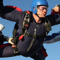
On this airport you can find skydive centers. The only known company on this field is Skydive Leipzig.
Companies

Skydive centers

Add company

References

Nearby airports

Airport ID Distance Direction
Laussig Agricultural Airstrip DE-0415 11 km 114°
Agrarflugplatz Brodau DE-0414 14 km 232°
Balloonport Bitterfeld DE-0351 15 km 290°
Flugplatz Renneritz EDOX 18 km 276°
Flugplatz Taucha EDCT 20 km 171°
Agrar-Flugfeld Zwochau DE-0427 22 km 234°
Leipzig St. Georg DE-0796 23 km 201°
Leipzig/Halle Airport EDDP 25 km 226°
Agrarflugfeld Machern DE-0425 26 km 161°

Navigational aids

Name Ident Type Distance Direction
Leipzig LEG VOR-DME 16 km 185°
Leipzig ZIG NDB 22 km 223°
Leipzig MA NDB 23 km 207°
Leipzig North LND DME 25 km 229°
Leipzig South LED DME 26 km 225°
Report a change