Schaffen Airfield

EBDT · Vlaams-Brabant, Flanders, Belgium

About Schaffen Airfield

ICAO EBDT
FIR Bruxelles FIR
Region Flanders
Country Belgium
Runways 6/24
Type Small airport
Coordinates (ARP) 50.9992, 5.06556   505957N 0050356E
Coordinates (Center) 51.00416, 5.06503   510015N 0050354E
Variation 2.5° E (2024)
Timezone Brussels (+2 h)
Local time Apr 27, 2024 19:57

Runways

ID True Heading Magnetic Heading Length Width Surface Latitude Longitude
6 057° 054° 750 m 45 m Grass 51.0060 5.0696
24 237° 234° 51.0023 5.0605

Do not use for flight planning
The airport may be closed or require prior permission. True headings and the coordinates of runway ends may be an estimation. Magnetic headings are calculated from true headings using the WMM 2020 model.

Schaffen Airfield

Schaffen Airfield is a small airport in Vlaams-Brabant, Flanders, Belgium. The airport is located at latitude 51.00416 and longitude 5.06503. The airport has one runway: 6/24. The ICAO airport code of this field is EBDT. Nearby other airfields are Leopoldsburg Airfield, Kiewit Airfield Hasselt, Balen-Keiheuvel Airfield, Brustem Airfield Sint Truiden and Goetsenhoven Airfield.

Schaffen Airfield publishes a METAR. The flight information region (FIR) is Bruxelles.

Schaffen Airfield is in the timezone of Europe/Brussels. Difference with UTC is +2 h. Today the sun rises at 06:19 and sets at 20:55. This applies to Schaffen Airfield, the universal daylight period may be different. The difference between the local time and UTC is +2 hour. Daylight saving time is currently in progress.

Things to do at this airport

Go to Vliegles.nl to find flying lessons, skydives and other flying experiences. Browse the page for all available activities near Schaffen Airfield. You can also use the search function to find specific flying lessons, skydives or other flying experiences near your place.

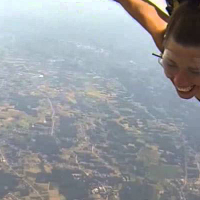
On this airport you can find skydive centers. The only known company on this field is Skydive Flanders - DZ Schaffen.
Companies

Skydive centers

Add company

References

Nearby airports

Airport ID Distance Direction
Diest / Webbekom EBDW 5.1 km 180°
Bekkevoort Heliport EBRU 6.2 km 213°
Halen Heliport EBHL 8.2 km 171°
Ham heliport EBHA 8.9 km 020°
Lummen heliport EBLU 12 km 096°
Stevoort Heliport EBHS 15 km 127°
Sint Joris Winge EBEM 18 km 232°
Houthalen heliport EBHT 21 km 086°
Leopoldsburg Airfield EBLE 21 km 052°

Navigational aids

Name Ident Type Distance Direction
Flora FLO VOR-DME 15 km 161°
Bruno BUN VOR-DME 20 km 309°
Report a change