Westlock Airport

CES4 · Alberta, Canada

About Westlock Airport

ID CES4
FIR Edmonton FIR
Region Alberta
Country Canada
Runways 10/28
Type Small airport
Coordinates (ARP) 54.1422, -113.741   540832N 1134428W
Coordinates (Center) 54.1418, -113.74042   540830N 1134426W
Variation 14.1° E (2024)
Timezone Edmonton (-6 h)
Local time May 2, 2024 22:33

Runways

ID True Heading Magnetic Heading Length Width Surface Latitude Longitude
10 116° 101° 2,999 ft 75 ft Asphalt 54.1398 -113.7334
28 296° 281° 54.1438 -113.7475

Do not use for flight planning
The airport may be closed or require prior permission. True headings and the coordinates of runway ends may be an estimation. Magnetic headings are calculated from true headings using the WMM 2020 model.

Westlock Airport

Westlock Airport is a small airport in Alberta, Canada. The airport is located at latitude 54.14180 and longitude -113.74042. The airport has one runway: 10/28. This airport has a pseudo ICAO code of CES4. Nearby other airfields are Hnatko Farms Airport, Edmonton/Morinville (Mike's Field), Edmonton/Morinville (Currie Field), Barrhead Airport and Abee Agdm.

Westlock Airport does not publish a METAR, the nearest weather station is Edmonton / Villeneuve Airport, which is 29 NM away. The flight information region (FIR) is Edmonton.

Westlock Airport is in the timezone of America/Edmonton. Difference with UTC is -6 h. Today the sun rises at 05:51 and sets at 21:11. This applies to Westlock Airport, the universal daylight period may be different. The difference between the local time and UTC is -6 hour. Daylight saving time is currently in progress.

Things to do at this airport

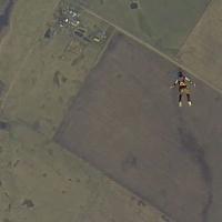
Go to Vliegles.nl to find flying lessons, skydives and other flying experiences. Browse the page for all available activities near Westlock Airport. You can also use the search function to find specific flying lessons, skydives or other flying experiences near your place.

On this airport you can find skydive centers. The only known company on this field is Edmonton Skydive.

Companies

Skydive centers

Add company

References

Nearby airports

Airport ID Distance Direction
Westlock Healthcare Centre Heliport CAA3 4.0 NM 274°
Dapp Agdm CXDP 12 NM 329°
Hnatko Farms Airport CHF3 14 NM 284°
Edmonton/Morinville (Mike's Field) CMN6 19 NM 161°
Edmonton/Morinville (Currie Field) CCF6 19 NM 182°
Barrhead (Healthcare Centre) Heliport CA-0979 23 NM 267°
Barrhead (Healthcare Centre) Heliport CHC3 23 NM 266°
Redwater Health Centre Heliport CRW8 25 NM 117°
Barrhead Airport CEP3 25 NM 264°

Navigational aids

Name Ident Type Distance Direction
Westlock 9Z NDB-DME 0.3 NM 286°
Report a change