Samedan Airport

LSZS · Grisons, Switzerland

About Samedan Airport

ICAO LSZS
IATA SMV
FIR Switzerland FIR
Region Grisons
Country Switzerland
Runways 3/21
Type Midsized airport
Coordinates (ARP) 46.5341, 9.88411   463203N 0095303E
Variation 3.7° E (2024)
Timezone Zurich (+2 h)
Local time May 2, 2024 10:19

Runways

ID True Heading Magnetic Heading Length Width Surface Latitude Longitude
3 028° 024° 1,800 m 40 m Asphalt 46.5414 9.8900
21 208° 204° 46.5268 9.8783

Do not use for flight planning
The airport may be closed or require prior permission. True headings and the coordinates of runway ends may be an estimation. Magnetic headings are calculated from true headings using the WMM 2020 model.

Samedan Airport

Samedan Airport is a midsized airport in Grisons, Switzerland. The airport is located at latitude 46.53410 and longitude 9.88411. The airport has one runway: 3/21. The ICAO airport code of this field is LSZS. The airport's IATA code is SMV. Nearby other airfields are Sondrio Caiolo Airport, Campo di Volo Samolaco, Resia Pass, Bad Ragaz Airport and Aviosuperficie "Passo del Tonale".

Samedan Airport publishes a METAR. The flight information region (FIR) is Switzerland.

Samedan Airport is in the timezone of Europe/Zurich. Difference with UTC is +2 h. Today the sun rises at 06:03 and sets at 20:31. This applies to Samedan Airport, the universal daylight period may be different. The difference between the local time and UTC is +2 hour. Daylight saving time is currently in progress.

Things to do at this airport

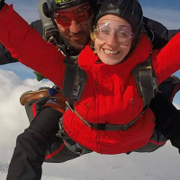
Go to Vliegles.nl to find flying lessons, skydives and other flying experiences. Browse the page for all available activities near Samedan Airport. You can also use the search function to find specific flying lessons, skydives or other flying experiences near your place.

On this airport you can find flying schools and skydive centers. Companies on this airport are Swiss Jet and Engadin Sky.

Companies

Flying schools

Skydive centers

Add company

Nearby airports

Airport ID Distance Direction
Spital Oberengadin LSHE 0.8 km 328°
Helipad Klinik Gut (St. Moritz) CH-0005 5.4 km 219°
St Moritz-Bad Heliport LSXM 7.7 km 216°
Fuorcla Grischa LSVH 7.7 km 254°
Fuorcla Chamuotsch LSYF 11 km 250°
Vadret Dal Corvatsch LSYV 14 km 199°
Helipad Station Corvatsch CH-0006 14 km 200°
Regionalspital Davos LSHD 29 km 349°
Arosa LSVA 31 km 330°

Navigational aids

Name Ident Type Distance Direction
Corvatsch CVA DME 14 km 200°
Report a change