METAR Newport State Airport - KUUU/NPT
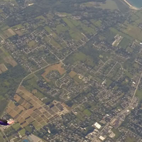
Newport State Airport is a midsized airport in Rhode Island, United States. The airport is located at latitude 41.53244 and longitude -71.28154. The airport has 2 runways: 4/22 and 16/34. The ICAO airport code of this field is KUUU. The local airport ID (FAA LID) of this airport is UUU. The airport's IATA code is NPT. The airport is in the Boston FIR.
This aviation weather observation was made for Rhode Island TF Green International Airport on April 27, 2024 15:51, local time.
Airport observations
The wind is from direction 220° with a speed of 16 kt. Wind gusts of 22 kt have been measured.
Visibility is 10 mi.
There are scattered clouds at an altitude of 20,000 ft and broken clouds at an altitude of 25,000 ft. The ceiling, broken or more, is 25,000 ft.
The temperature and wind chill are 16 °C. The air pressure at sea level is 30.41 inHg (QNH).
Daylight period
Today the sun rises at 05:46 and sets at 19:39. This applies to Newport State Airport, the universal daylight period may be different. The difference between the local time and UTC is -4 hour. Daylight saving time is currently in progress.
Companies
On this airport you can find flying schools and skydive centers. Companies on this airport are Newport Aviation and Skydive Newport.
Experiences
Go to Vliegles.nl to find flying lessons, skydives and other flying experiences. Browse the page for all available activities near Newport State Airport. You can also use the search function to find specific flying lessons, skydives or other flying experiences near your place.