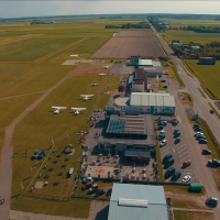
Texel International Airport
Texel International Airport is a small airport in North Holland, Netherlands. The airport is located at latitude 53.11402 and longitude 4.83003. The airport has 2 runways: 3/21 and 12/30. The ICAO airport code of this field is EHTX. Nearby other airfields are De Kooy Airfield, Vlieland Heliport, Slootdorp, L9-FF-1 and Leeuwarden Air Base.
Texel International Airport does not publish a METAR, the nearest weather station is De Kooy Airfield, which is 21 km away. The flight information region (FIR) is Amsterdam.
Texel International Airport is in the timezone of Europe/Amsterdam. Difference with UTC is +2 h. Today the sun rises at 06:20 and sets at 20:57. This applies to Texel International Airport, the universal daylight period may be different. The difference between the local time and UTC is +2 hour. Daylight saving time is currently in progress.Things to do at this airport
You can make a tandem skydive with an experienced instructor at this airport. These skydives include a free fall. The cost of a skydive at Texel International Airport is € 199. Make your reservation for Skydiving here.
On this airport you can find skydive centers and flying schools. Companies on this airport are Vliegles.nl, Paracentrum Texel, Zweefvliegclub Texel and Tessel Air.