Jacarepaguá - Roberto Marinho Airport

SBJR · Rio de Janeiro, Brazil

About Jacarepaguá - Roberto Marinho Airport

ICAO SBJR
IATA RRJ
FIR Curitiba FIR
Region Rio de Janeiro
Country Brazil
Runways 3/21
Type Small airport
Coordinates (ARP) -22.98677, -43.37219   225912S 0432220W
Variation 23.0° W (2024)
Timezone Sao_Paulo (-3 h)
Local time Apr 25, 2024 08:10

Runways

ID True Heading Magnetic Heading Length Width Surface Latitude Longitude
3 003° 026° 900 m 30 m Asphalt -22.9828 -43.3719
21 183° 206° -22.9908 -43.3725

Do not use for flight planning
The airport may be closed or require prior permission. True headings and the coordinates of runway ends may be an estimation. Magnetic headings are calculated from true headings using the WMM 2020 model.

Jacarepaguá - Roberto Marinho Airport

Jacarepaguá - Roberto Marinho Airport is a small airport in Rio de Janeiro, Brazil. The airport is located at latitude -22.98677 and longitude -43.37219. The airport has one runway: 3/21. The ICAO airport code of this field is SBJR. The airport's IATA code is RRJ. Nearby other airfields are Clube Ceu, Campo Délio Jardim de Mattos Airport, Santos Dumont Airport, Rio Galeão – Tom Jobim International Airport and Novaiguaçu Aeroclube.

Jacarepaguá - Roberto Marinho Airport publishes a METAR. The flight information region (FIR) is Curitiba.

Jacarepaguá - Roberto Marinho Airport is in the timezone of America/Sao_Paulo. Difference with UTC is -3 h. Today the sun rises at 06:10 and sets at 17:31. This applies to Jacarepaguá - Roberto Marinho Airport, the universal daylight period may be different. The difference between the local time and UTC is -3 hour. Daylight saving time is currently in progress.

Things to do at this airport

Go to Vliegles.nl to find flying lessons, skydives and other flying experiences. Browse the page for all available activities near Jacarepaguá - Roberto Marinho Airport. You can also use the search function to find specific flying lessons, skydives or other flying experiences near your place.

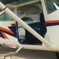
On this airport you can find skydive centers. The only known company on this field is Barra Jumping.
Companies

Skydive centers

Add company

References

Nearby airports

Airport ID Distance Direction
Hospital Samaritano Heliport BR-0802 0.7 km 188°
Clube Ceu SDIN 0.7 km 308°
Ten. Brig. Ar Waldir de Vasconcelos Heliport BR-1906 0.8 km 311°
AGO Helipad BR-1132 2.0 km 029°
Clube Céu Heliport BR-2365 2.1 km 298°
Shering Plough Heliport SDSF 2.7 km 359°
Ecobalsa / Flyone Heliport BR-1190 2.8 km 191°
Mário Henrique Simonsen Heliport SIYV 2.9 km 112°
Barra Green Heliport SDBG 3.4 km 130°

Navigational aids

Name Ident Type Distance Direction
Jacarepagua JPG NDB 0.4 km 110°
Afonsos AFS NDB 13 km 002°
Meriti IT NDB 18 km 003°
Caxias CAX VOR-DME 24 km 009°
Rasa IH NDB 25 km 110°
Ilha YLA NDB 31 km 043°
Report a change