Bacacheri Airport

SBBI · Paraná, Brazil

About Bacacheri Airport

ICAO SBBI
IATA BFH
FIR Curitiba FIR
Region Paraná
Country Brazil
Runways 18/36
Type Midsized airport
Coordinates (ARP) -25.4051, -49.232   252418S 0491355W
Variation 20.3° W (2024)
Timezone Sao_Paulo (-3 h)
Local time Apr 16, 2024 13:15

Runways

ID True Heading Magnetic Heading Length Width Surface Latitude Longitude
18 157° 177° 1,390 m 30 m Asphalt -25.4109 -49.2294
36 337° 357° -25.3993 -49.2346

Do not use for flight planning
The airport may be closed or require prior permission. True headings and the coordinates of runway ends may be an estimation. Magnetic headings are calculated from true headings using the WMM 2020 model.

Bacacheri Airport

Bacacheri Airport is a midsized airport in Paraná, Brazil. The airport is located at latitude -25.40510 and longitude -49.23200. The airport has one runway: 18/36. The ICAO airport code of this field is SBBI. The airport's IATA code is BFH. Nearby other airfields are Piraquara Airport, Ultraleve Clube Curitiba Airport, Afonso Pena Airport, Graciosa Airport and Max Fontoura Airport.

Bacacheri Airport publishes a METAR. The flight information region (FIR) is Curitiba.

Bacacheri Airport is in the timezone of America/Sao_Paulo. Difference with UTC is -3 h. Today the sun rises at 06:32 and sets at 18:00. This applies to Bacacheri Airport, the universal daylight period may be different. The difference between the local time and UTC is -3 hour. Daylight saving time is currently in progress.

Things to do at this airport

Go to Vliegles.nl to find flying lessons, skydives and other flying experiences. Browse the page for all available activities near Bacacheri Airport. You can also use the search function to find specific flying lessons, skydives or other flying experiences near your place.

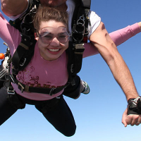
On this airport you can find flying clubs and skydive centers. Companies on this airport are Aeroclube do Paraná, Pecos Paraquedismo and Salto Duplo Curitiba.

Companies

Flying clubs

Skydive centers

Add company

References

Nearby airports

Airport ID Distance Direction
Polícia Federal Curitiba Heliport SSJF 3.4 km 006°
Hospital Universitário Cajuru Helipad BR-1474 3.7 km 200°
CJB Curitiba Heliport BR-0483 3.8 km 193°
Life Hotel Heliport SDVZ 4.3 km 239°
Valmor Weiss Heliport SJHV 4.9 km 193°
IURD Helipad BR-1471 5.1 km 215°
Estação Convention Center Helipad SJAJ 5.2 km 223°
Centro Século XXI Heliport SIDK 5.6 km 233°
Laguna Iguaçu Helipad BR-0643 7.5 km 229°

Navigational aids

Name Ident Type Distance Direction
Bacacheri BCH NDB 0.4 km 048°
Gisa IC NDB 6.6 km 194°
Curitiba CRT NDB 14 km 155°
Curitiba CTB VOR-DME 16 km 155°
Pinhais PNH NDB 27 km 147°
Report a change