Kaposvar Kaposújlak Airfield
Kaposvar Kaposújlak Airfield is a small airport in Somogy, Hungary. The airport is located at latitude 46.38640 and longitude 17.73348. The airport has one runway: 17/35. The ICAO airport code of this field is LHKV. Nearby other airfields are Taszár Air Base, Kadarkút, Kutas/Hertelendy, Balatonlelle sárkány repülőtér and Balatonkeresztúr Airfield.
Kaposvar Kaposújlak Airfield does not publish a METAR, the nearest weather station is Hévíz–Balaton Airport, which is 55 km away. The flight information region (FIR) is Budapest.
Kaposvar Kaposújlak Airfield is in the timezone of Europe/Budapest. Difference with UTC is +2 h. Today the sun rises at 05:53 and sets at 19:42. This applies to Kaposvar Kaposújlak Airfield, the universal daylight period may be different. The difference between the local time and UTC is +2 hour. Daylight saving time is currently in progress.Things to do at this airport
Go to Vliegles.nl to find flying lessons, skydives and other flying experiences. Browse the page for all available activities near Kaposvar Kaposújlak Airfield. You can also use the search function to find specific flying lessons, skydives or other flying experiences near your place.
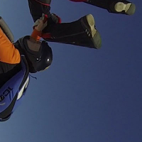
On this airport you can find flying schools and skydive centers. Companies on this airport are Noir Flight Academy and KaposDZ.