Le Havre Octeville

LFOH · Seine-Maritime, Normandy, France

About Le Havre Octeville

ICAO LFOH
IATA LEH
FIR Paris FIR
Region Normandy
Country France
Runways 4/22
Type Midsized airport
Coordinates (ARP) 49.53327, 0.08898   493160N 0000520E
Coordinates (Center) 49.53405, 0.08846   493203N 0000518E
Variation 1.1° E (2024)
Timezone Paris (+2 h)
Local time Apr 24, 2024 04:21

Runways

ID True Heading Magnetic Heading Length Width Surface Latitude Longitude
4 043° 041° 2,300 m 40 m Asphalt 49.5416 0.0993
22 223° 221° 49.5265 0.0776

Do not use for flight planning
The airport may be closed or require prior permission. True headings and the coordinates of runway ends may be an estimation. Magnetic headings are calculated from true headings using the WMM 2020 model.

Le Havre Octeville

Le Havre Octeville is a midsized airport in Seine-Maritime, Normandy, France. The airport is located at latitude 49.53405 and longitude 0.08846. The airport has one runway: 4/22. The ICAO airport code of this field is LFOH. The airport's IATA code is LEH. Nearby other airfields are Deauville-Saint-Gatien Airport, Havre-Saint-Romain-de-Colbosc Airport, Yvetot Lucien Camu Airport, Aérodrome de Saint-Valery-Vittefleur and Caen-Carpiquet Airport.

Le Havre Octeville publishes a METAR. The flight information region (FIR) is Paris.

Le Havre Octeville is in the timezone of Europe/Paris. Difference with UTC is +2 h. Today the sun rises at 06:48 and sets at 21:06. This applies to Le Havre Octeville , the universal daylight period may be different. The difference between the local time and UTC is +2 hour. Daylight saving time is currently in progress.

Things to do at this airport

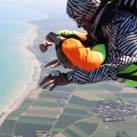
Go to Vliegles.nl to find flying lessons, skydives and other flying experiences. Browse the page for all available activities near Le Havre Octeville . You can also use the search function to find specific flying lessons, skydives or other flying experiences near your place.

On this airport you can find flying clubs and skydive centers. Companies on this airport are Aéroclub du Havre Jean Maridor and Abeille Parachutisme.

Companies

Flying clubs

Skydive centers

Add company

References

Nearby airports

Airport ID Distance Direction
Hopital Jacques Monod Heliport FR-0156 7.0 km 098°
La Ferme Saint Siméon Heliport FR-0147 16 km 141°
Usine Renault Heliport FR-0157 17 km 112°
Deauville-Saint-Gatien Airport LFRG 19 km 165°
Havre-Saint-Romain-de-Colbosc Airport LFOY 20 km 086°
Berville-Sur-Mer FR-0589 23 km 118°
Centre Hospitalier Heliport FR-0154 32 km 042°
Bonneville La Louvet FR-0602 36 km 145°
Victot-Pontfol FR-1142 41 km 188°

Navigational aids

Name Ident Type Distance Direction
Deauville DVL VOR 30 km 146°
Report a change