Tromsø Airport, Langnes

ENTC · Troms og Finnmark, Norway

About Tromsø Airport, Langnes

ICAO ENTC
IATA TOS
FIR Norway FIR
Region Troms og Finnmark
Country Norway
Runways 18/36
Type Large airport
Coordinates (ARP) 69.6833, 18.9189   694060N 0185508E
Variation 10.7° E (2024)
Timezone Oslo (+2 h)
Local time Apr 19, 2024 13:13

Runways

ID True Heading Magnetic Heading Length Width Surface Latitude Longitude
18 193° 182° 2,392 m 45 m Asphalt 69.6729 18.9119
36 013° 002° 69.6937 18.9259

Do not use for flight planning
The airport may be closed or require prior permission. True headings and the coordinates of runway ends may be an estimation. Magnetic headings are calculated from true headings using the WMM 2020 model.

Tromsø Airport, Langnes

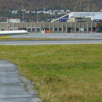
Tromsø Airport, Langnes is a large airport in Troms og Finnmark, Norway. The airport is located at latitude 69.68330 and longitude 18.91890. The airport has one runway: 18/36. The ICAO airport code of this field is ENTC. The airport's IATA code is TOS. Nearby other airfields are Villmobakken Airstrip, Bardufoss Airport, Sørkjosen Airport, Setermoen Airstrip and Elvenes.

Tromsø Airport, Langnes publishes a METAR. The flight information region (FIR) is Norway.

Tromsø Airport, Langnes is in the timezone of Europe/Oslo. Difference with UTC is +2 h. Today the sun rises at 04:18 and sets at 21:07. This applies to Tromsø Airport, Langnes, the universal daylight period may be different. The difference between the local time and UTC is +2 hour. Daylight saving time is currently in progress.

Things to do at this airport

Go to Vliegles.nl to find flying lessons, skydives and other flying experiences. Browse the page for all available activities near Tromsø Airport, Langnes. You can also use the search function to find specific flying lessons, skydives or other flying experiences near your place.

On this airport you can find skydive centers. The only known company on this field is Skydive Arctic.

Companies

Skydive centers

Add company

References

Nearby airports

Airport ID Distance Direction
Tromsø Heliport, University Hospital NO-0058 2.5 km 088°
Villmobakken Airstrip NO-0074 65 km 024°
Bardufoss Airport ENDU 71 km 192°
Sørkjosen Airport ENSR 79 km 080°
Setermoen Airstrip NO-0059 95 km 193°
Elvenes ENLV 98 km 202°
Kilpisjärvi Heliport EFEK 108 km 133°
Andøya Airport, Andenes ENAN 117 km 249°
Harstadt/Stangnes ENHR 136 km 223°

Navigational aids

Name Ident Type Distance Direction
Tromso TRO VOR-DME 3.7 km 054°
Lanes TM NDB 4.1 km 012°
Kvalsund KV NDB 15 km 012°
Kobbe KBV NDB 20 km 190°
Report a change