Jersey Airport

EGJJ · St Helier, Jersey

About Jersey Airport

ICAO EGJJ
IATA JER
FIR Brest FIR
Region St Helier
Country Jersey
Runways 8/26
Type Midsized airport
Coordinates (ARP) 49.2079, -2.19551   491228N 0021144W
Coordinates (Center) 49.20795, -2.19531   491229N 0021143W
Variation 0.4° E (2024)
Timezone Jersey (+1 h)
Local time Apr 16, 2024 08:52

Runways

ID True Heading Magnetic Heading Length Width Surface Latitude Longitude
8 083° 082° 1,706 m 45 m Asphalt 49.2089 -2.1837
26 263° 262° 49.207 -2.2069

Do not use for flight planning
The airport may be closed or require prior permission. True headings and the coordinates of runway ends may be an estimation. Magnetic headings are calculated from true headings using the WMM 2020 model.

Jersey Airport

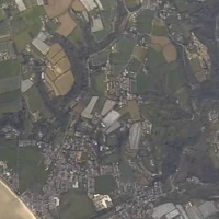
Jersey Airport is a midsized airport in St Helier, Jersey. The airport is located at latitude 49.20795 and longitude -2.19531. The airport has one runway: 8/26. The ICAO airport code of this field is EGJJ. The airport's IATA code is JER. Nearby other airfields are Guernsey Airport, Aérodrome de Lessay, Aérodrome de Vauville, Alderney Airport and Granville Airport.

Jersey Airport publishes a METAR. The flight information region (FIR) is Brest.

Jersey Airport is in the timezone of Europe/Jersey. Difference with UTC is +1 h. Today the sun rises at 06:13 and sets at 20:02. This applies to Jersey Airport, the universal daylight period may be different. The difference between the local time and UTC is +1 hour. Daylight saving time is currently in progress.

Things to do at this airport

Go to Vliegles.nl to find flying lessons, skydives and other flying experiences. Browse the page for all available activities near Jersey Airport. You can also use the search function to find specific flying lessons, skydives or other flying experiences near your place.

On this airport you can find skydive centers. The only known company on this field is Skydive Jersey.

Companies

Skydive centers

Add company

Nearby airports

Airport ID Distance Direction
Portbail FR-1001 38 km 067°
Guernsey Airport EGJB 39 km 310°
Flamanville FR-0733 43 km 031°
Flamanville Heliport FR-0145 43 km 031°
Chausey Heliport FR-0464 46 km 143°
Aérodrome de Lessay LFOM 50 km 090°
Aérodrome de Vauville LFAU 53 km 029°
Alderney Airport EGJA 55 km 358°
Crossma Heliport FR-0143 57 km 021°

Navigational aids

Name Ident Type Distance Direction
Jersey JSY VOR-DME 11 km 082°
Report a change