Adolf Würth Airport

EDTY · Baden-Württemberg, Germany

About Adolf Würth Airport

ICAO EDTY
FIR Langen FIR
Region Baden-Württemberg
Country Germany
Runways 10/28
Type Midsized airport
Coordinates (ARP) 49.11833, 9.78389   490706N 0094702E
Coordinates (Center) 49.11835, 9.78364   490706N 0094701E
Variation 3.8° E (2024)
Timezone Berlin (+2 h)
Local time Apr 19, 2024 06:36

Runways

ID True Heading Magnetic Heading Length Width Surface Latitude Longitude
10 096° 092° 1,540 m 30 m Concrete 49.1173 9.7941
28 276° 272° 49.1194 9.7732

Do not use for flight planning
The airport may be closed or require prior permission. True headings and the coordinates of runway ends may be an estimation. Magnetic headings are calculated from true headings using the WMM 2020 model.

Adolf Würth Airport

Adolf Würth Airport is a midsized airport in Baden-Württemberg, Germany. The airport is located at latitude 49.11835 and longitude 9.78364. The airport has one runway: 10/28. The ICAO airport code of this field is EDTY. Nearby other airfields are Schwäbisch Hall-Weckrieden Airfield, Mittelfischach UL, Oberrot-Glashofen UL, Morbach UL and Obersöllbach UL.

Adolf Würth Airport publishes a METAR. The flight information region (FIR) is Langen.

Adolf Würth Airport is in the timezone of Europe/Berlin. Difference with UTC is +2 h. Today the sun rises at 06:20 and sets at 20:19. This applies to Adolf Würth Airport, the universal daylight period may be different. The difference between the local time and UTC is +2 hour. Daylight saving time is currently in progress.

Things to do at this airport

Go to Vliegles.nl to find flying lessons, skydives and other flying experiences. Browse the page for all available activities near Adolf Würth Airport. You can also use the search function to find specific flying lessons, skydives or other flying experiences near your place.

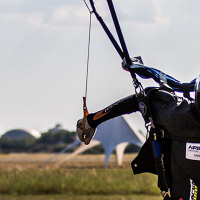
On this airport you can find skydive centers. Companies on this airport are Paraclub Hall and Blue Sky Adventures.
Companies

Skydive centers

Add company

References

Nearby airports

Airport ID Distance Direction
Schwäbisch Hall-Weckrieden Airfield EDTX 0.7 km 344°
Schwaebisch Hall Diakonie-Krhs. DE-0948 3.1 km 284°
Mittelfischach UL DE-0376 11 km 145°
Oberrot-Glashofen UL DE-0401 16 km 221°
Morbach UL DE-0394 17 km 236°
Obersöllbach UL DE-0413 18 km 293°
Hermuthausen Airfield DE-0306 22 km 352°
Sonderlandeplatz Ingelfingen-Bühlhof EDGI 24 km 338°
Weipertshofen Airfield DE-0213 25 km 097°

Navigational aids

Name Ident Type Distance Direction
Schwabisch SHD DME 0.4 km 242°
Report a change